In geography and navigation—and in everyday life—the concepts of absolute and relative location are fundamental to understanding how we define and describe places on Earth.
Relative location describes a place in relation to other landmarks or features, such as “north of the river” or “near the downtown area.”
For example: The relative location of the Eiffel Tower is near the Seine River in the heart of Paris, close to the Champ de Mars.
Absolute location refers to the precise coordinates of a point, and is often defined using latitude and longitude or a specific address.
For example: The absolute location of the Eiffel Tower is 48.8584° N, 2.2945° E.

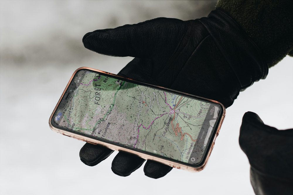
For drone pilots, absolute location ensures precise flight paths and accurate mapping while relative location helps describe the drone’s position in relation to landmarks, aiding communication and situational awareness.
This guide covers the difference between relative and absolute location, looking at examples of each, why the concepts matter for drone operations, and a lot more.
Use the menu below to jump around, or keep reading for the full guide.
- Relative Location vs. Absolute Location
- Why Relative and Absolute Location Matters for Drone Pilots
- Relative Location: Understanding Places in Context
- Absolute Location Definition: What It Is and How It Works
- The History and Evolution of Location Systems
- Relative Location and Absolute Location FAQ
Relative Location vs. Absolute Location
While absolute location provides pinpoint accuracy, relative location gives us contextual understanding.
Both locational concepts are vital in a wide range of applications, from creating maps to navigating city streets—or tracking drone operations. Together, they offer a comprehensive framework for understanding and navigating the world.
To kick things off, here’s a comparison table for relative and absolute location with examples, applications, tools, and the precision you can expect from each one.
The table highlights how absolute location excels in precision and technical applications, while relative location provides contextual understanding that is intuitive and flexible.
| Feature | Absolute Location | Relative Location |
|---|---|---|
| Definition | Refers to a fixed, precise position on Earth, typically defined by coordinates or an address. | Describes a place in relation to other landmarks, features, or geographic points. |
| Examples | Coordinates: 40.7128° N, 74.0060° W (New York City); Address: 221B Baker Street, London. | “2 miles north of the river,” “next to the library,” or “near Central Park.” |
| Precision | Highly precise and consistent regardless of context. | Context-dependent and can vary based on landmarks or the observer’s perspective. |
| Applications | GPS navigation, drone operations, geographic mapping, and urban planning. | Everyday directions, regional descriptions, tourism, and localized navigation. |
| Tools | GPS devices, GIS software, latitude/longitude systems, and online maps like Google Maps. | Landmarks, verbal instructions, wayfinding apps, and visual references. |
Why Understanding Location Matters
Understanding the difference between absolute and relative location goes beyond academic geography—it plays a key role in our everyday lives.
In logistics, absolute location is essential for routing deliveries and managing global supply chains. Mapping technologies like GPS rely on absolute location to provide precise directions, while relative location helps users understand their surroundings and navigate efficiently.
And in advanced fields like drone operations, absolute location allows drones to follow precise flight paths and perform tasks like powerline inspections or crop monitoring, while relative location helps operators describe a drone’s position relative to landmarks.
When to Use Absolute Location vs. Relative Location
Knowing when to use absolute or relative location depends on the task at hand.
Absolute location is indispensable in scenarios that require precision, such as programming a drone’s flight path, plotting coordinates on a map, or finding a specific address. Its unchanging nature ensures accuracy across diverse applications.
On the other hand, relative location is more practical in everyday communication and casual navigation.
For example, giving directions to a friend (“The restaurant is next to the post office”) or describing a place’s position relative to a landmark (“The campsite is on the north side of the lake”) relies on relative location. It’s especially useful in contexts where familiarity with local landmarks help with understanding.
The Intersection of Absolute and Relative Location
In many cases, absolute and relative location work together to provide a comprehensive understanding.
For example, a GPS device might guide you to an exact latitude and longitude (absolute location) while also suggesting landmarks or turns (relative location) to help you navigate effectively. This combination ensures that users have both the accuracy and relative context needed to reach their destinations.
4 Common Misconceptions About Location Terms
The concepts of absolute and relative location are widely used but are often misunderstood.
Here are four common misconceptions about the two terms, with examples to help clarify where needed.
1. Absolute Location Only Refers to Addresses
Many people mistakenly believe that absolute location is limited to street addresses.
While addresses like “1600 Pennsylvania Avenue NW, Washington, D.C.” are valid examples of absolute location, it can also include coordinates such as latitude and longitude (e.g., 40.6892° N, 74.0445° W for the Statue of Liberty) or other fixed geographic markers.
2. Absolute Location Is Only Relevant to Physical Maps
Another common misunderstanding is that absolute location is tied exclusively to physical maps. In reality, it is widely used in digital systems like GPS navigation, drone operations, and GIS mapping.
These systems rely on precise coordinates to function effectively, integrating absolute location into modern technology.
3. Relative Location Only Involves Cardinal Directions
People often assume that relative location is limited to terms like north, south, east, and west. However, relative location is much more flexible and includes references to landmarks, distances, or orientation.
For example:
- Landmark Example: “The coffee shop is across the street from the library.”
- Distance Example: “The park is 2 miles south of the city center.”
- Orientation Example: “The building is on the left side of the road after the intersection.”
4. Relative Location Is Always Clear and Intuitive
While relative location can be practical in everyday contexts, its reliance on surrounding landmarks and context can lead to ambiguity. For instance, describing something as “near the big tree” may not be helpful if the listener is unfamiliar with the area.
This is why combining relative and absolute location can provide a more complete and precise understanding.
Why Relative and Absolute Location Matters for Drone Pilots
For drone pilots, understanding both absolute and relative location is essential for safe, efficient, and precise operations.
Whether conducting powerline inspections, delivering packages, or mapping terrain, these location concepts ensure that drones can navigate complex environments and complete their missions effectively.
Ensuring Precision with Absolute Location
Absolute location provides the exact coordinates needed for drones to operate with pinpoint accuracy.
Modern drones rely on GPS and other geospatial technologies to follow predefined flight paths and reach specific destinations.
Example use cases:
- Mapping and surveying. A drone conducting a topographic survey uses GPS coordinates to map an area with centimeter-level precision. This accuracy is essential for construction planning or environmental monitoring.
- Drone delivery. In package delivery services, drones use absolute location to navigate to exact delivery addresses, ensuring parcels reach their intended recipients efficiently and reliably.

Improving Situational Awareness with Relative Location
Relative location adds context to a drone’s position, describing where it is in relation to nearby landmarks or features.
This is especially valuable for situational awareness, communication, and adapting to dynamic environments.
Example use cases:
- Search and rescue missions. During an emergency, a drone operator might describe the drone’s position as “near the base of the hill” to coordinate efforts with ground teams. This relative description helps responders locate the drone and direct resources more effectively.
- Obstacle navigation. When flying in areas with potential hazards, such as near powerlines or tall buildings, a pilot can use relative location to describe positions like “30 feet above the rooftop” to ensure safe navigation and clear communication with team members.
The Intersection of Absolute and Relative Location
Commercial drone pilots often rely on a combination of absolute and relative location.
For instance, a drone may use GPS coordinates to fly to a designated point (absolute location) while the pilot observes its proximity to a tree line or structure (relative location) to ensure safety.
This interplay allows for precision and adaptability, making both location types important tools for modern drone operations.
Relative Location: Understanding Places in Context
Relative location describes the position of a place in relation to other locations or landmarks.
Unlike absolute location, which relies on fixed coordinates or addresses, relative location provides contextual information that can vary depending on perspective or the point of reference. This type of location is often used in everyday communication because it’s intuitive and helps people visualize where something is based on familiar surroundings.
For instance, saying a city is “50 miles north of New York City” or that a park is “next to the Cologne Cathedral” are examples of relative location (the Cologne Cathedral is shown below).

Relative Location Examples: Finding Your Place in the World
To help make the concept more concrete, here are three examples of relative location:
1. City Proximity
“Philadelphia is located approximately 90 miles southwest of New York City.”
This statement gives a clear sense of where Philadelphia is in relation to a major urban center.
2. Landmark References
“The coffee shop is across the street from the town square.”
This helps orient someone based on a recognizable local feature.
3. Geographic Features
“The village is nestled on the eastern slope of the mountain range.”
Here, the mountain serves as a natural point of reference.
Common Use Cases for Relative Location
Relative location plays a crucial role in many fields by providing contextual understanding of places in relation to their surroundings.
Here are four common use cases for relative location.

1. Urban Planning
Urban planners use relative location to design and organize cities in ways that make them more livable and efficient.
For example, they may determine the placement of schools, parks, and public transit stations based on their proximity to residential areas. This helps ensure accessibility and promotes cohesive development that meets the needs of local communities.
2. Navigation and Travel
Relative location is essential in navigation and travel, where landmarks and contextual directions guide people to their destinations.
Travelers often use relative descriptions like “the hotel is next to the museum” or “the restaurant is across from the train station” to orient themselves in unfamiliar areas. Wayfinding apps and tour guides also rely on relative location to make navigation intuitive and user-friendly.
3. Retail and Real Estate
Retail businesses and real estate agents frequently use relative location to highlight the value of a property or storefront.
For instance, a property listing might emphasize its proximity to amenities like shopping centers, schools, and parks. Similarly, retailers choose locations near high-traffic areas or landmarks to maximize visibility and attract customers.
4. Emergency Response and Disaster Management
Relative location is critical in emergency response scenarios where time is of the essence.
First responders use relative terms to describe locations, such as “the incident is two blocks north of the fire station” or “near the east entrance of the park,” to coordinate efforts effectively. This contextual information helps teams respond quickly and efficiently, even in chaotic or unfamiliar environments.
Absolute Location Definition: What It Is and How It Works
Absolute location refers to the exact, fixed position of a place on the Earth’s surface, determined by a specific set of coordinates or a detailed description. It’s the cornerstone of modern mapping and navigation technologies, from GPS systems that guide drivers to geospatial tools used in industries like construction, logistics, and drone operations.
Unlike relative location, which depends on context and landmarks, absolute location remains consistent and does not change based on perspective or surroundings.
Typically, latitude and longitude are used to define absolute location, as they provide a universal system for pinpointing any point on the globe. For instance, the absolute location of the Statue of Liberty is 40.6892° N, 74.0445° W.
Absolute Location Examples: Pinpointing Locations with Precision
Here are three examples of absolute location:
1. Latitude and Longitude
The coordinates 51.5074° N, 0.1278° W point to London, England.
This method is used globally for everything from international navigation to tracking satellites.
2. Street Address
A more familiar form of absolute location is a specific address, such as “1600 Pennsylvania Avenue NW, Washington, D.C.,” which identifies the White House.
Street addresses provide fixed and universally recognized locations within cities and towns.
3. UTM Coordinates
The Universal Transverse Mercator (UTM) system uses a grid to divide the Earth into zones, offering a precise method for mapping in fields like surveying and military operations.
Common Use Cases for Absolute Location
Absolute location is a cornerstone of precision and reliability, making it indispensable in various fields.
Here are four common use cases for absolute location.

1. Drone Operations
Drone operators depend on absolute location to program precise flight paths and execute missions effectively.
GPS coordinates guide drones to exact inspection points, whether it’s surveying powerlines, mapping farmland, or monitoring construction sites. Absolute location ensures accuracy, reducing errors and improving efficiency in both manual and automated operations.
2. Cartography and Geographic Information Systems (GIS)
Absolute location is fundamental to cartography and GIS, enabling the creation of detailed maps and spatial analyses.
Cartographers use latitude and longitude coordinates to mark exact locations on maps, while GIS tools overlay geographic data to analyze patterns and trends. This precision is crucial for applications like urban development, environmental monitoring, and disaster management.
3. Logistics and Supply Chain Management
In logistics, absolute location is essential for route optimization and tracking.
Delivery services like FedEx and Amazon use GPS technology to navigate to exact addresses, ensuring packages reach their destinations efficiently.
Fleet management systems also rely on absolute location to monitor vehicles in real time, improving delivery times and resource allocation.
4. Aviation and Maritime Navigation
Pilots and ship captains use absolute location to plot courses and avoid obstacles.
In aviation, flight plans are built around exact waypoints defined by coordinates, ensuring safe and efficient travel.
Similarly, maritime navigation relies on precise GPS data to guide ships through vast oceans and congested waterways.
The History and Evolution of Location Systems
The concepts of absolute and relative location have been central to the human understanding of geography for centuries.
From the earliest maps created by ancient civilizations to the advanced GPS systems of today, location systems have continually evolved, becoming more precise and technologically sophisticated over time.
In this section, we’ll explore the origins of these concepts and how modern advancements have shaped their usage.

The Origins of Location Systems
Early humans relied heavily on relative location to navigate and describe their surroundings. Ancient cartographers and explorers used landmarks, natural features, and cardinal directions to communicate the position of places.
For example, rivers, mountains, and coastlines were critical reference points for understanding and traversing unfamiliar terrain.
One of the earliest known maps, created in Mesopotamia around 2300 BCE, used relative descriptions to depict trade routes and settlements in relation to rivers and other geographic features. Similarly, ancient sailors used celestial navigation, relying on the stars and the sun’s position to determine their relative location at sea.
The concept of absolute location began to take shape with the development of coordinate systems.
The ancient Greeks made significant contributions to this understanding, with figures like Eratosthenes and Ptolemy laying the groundwork for latitude and longitude. These early systems allowed for a more precise way to pinpoint locations on Earth, paving the way for modern cartography.
How GPS Revolutionized Absolute Location
The invention of the Global Positioning System (GPS) in the 20th century revolutionized the use of absolute location.
Originally developed by the U.S. Department of Defense in the 1970s, GPS became widely available for civilian use in the 1980s and 1990s. By using a network of satellites orbiting the Earth, GPS provides highly accurate location data anywhere on the planet.
This breakthrough transformed industries and everyday life.
Today, GPS is used in navigation apps like Google Maps, enabling precise turn-by-turn directions. It also plays a critical role in fields like logistics, aviation, and drone operations, where absolute location is essential for efficiency and safety.
In addition to GPS, advancements in Geographic Information Systems (GIS) have enhanced the ability to visualize and analyze location data.
GIS integrates absolute and relative location to create detailed maps and spatial models, supporting applications in urban planning, environmental monitoring, and disaster response.
The Ongoing Evolution of Location Systems
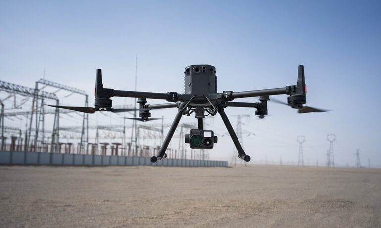
The evolution of location systems continues with the rise of new technologies, like real-time kinematic (RTK) positioning, which offers centimeter-level accuracy, are further refining the precision of absolute location.
Modern drones use RTK technology, even including the term in the name of the drone—see, for example, the DJI Matrice 350 RTK:
At the same time, tools like augmented reality (AR) and machine learning are enhancing the contextual understanding of relative location, making it more dynamic and interactive.
As these technologies advance, the interplay between absolute and relative location will become even more seamless, providing greater accuracy and context in everything from personal navigation to large-scale industrial operations.
Relative Location and Absolute Location FAQ
Have questions about relative location and absolute location?
Here are answers to some of the most common questions.
What is absolute location?
Absolute location refers to a fixed, precise position on Earth, defined using coordinates like latitude and longitude or a specific address.
What is relative location?
Relative location describes a place in relation to other landmarks, geographic features, or points of interest, such as “north of the lake” or “next to the museum.”
What is an example of absolute location?
Examples of absolute location include coordinates like 48.8566° N, 2.3522° E for Paris, France, or an address like “1600 Pennsylvania Avenue NW, Washington, D.C.”
What is an example of relative location?
An example of relative location is describing Paris as being “northeast of Bordeaux” or saying “the school is across the street from the park.”
What is the difference between absolute and relative location?
Absolute location provides a precise, unchanging position on Earth, while relative location describes a place in relation to nearby features or landmarks, which can vary depending on context.
Why is absolute location important in geography?
Absolute location is essential in geography because it allows for accurate mapping, navigation, and spatial analysis, ensuring precision in locating places and features on Earth.
How is relative location used in daily life?
Relative location is commonly used in everyday life to give directions, describe places, or communicate the position of one location relative to another, such as “the grocery store is next to the bank.”
Can relative location change?
Yes, relative location can change based on the observer’s perspective or shifts in surrounding landmarks, making it a flexible and context-dependent concept.
What is absolute location in geography?
In geography, absolute location is a fixed position defined by coordinates (latitude and longitude) or an address, used for mapping, navigation, and identifying specific points on Earth.
How is relative location important for drone operations?
Relative location is crucial for drone operations as it helps pilots describe a drone’s position in relation to landmarks, aiding situational awareness and communication during flights.
How is absolute location important for drone operations?
Absolute location is vital for drone operations because it ensures precise flight paths, accurate mapping, and effective task execution using GPS coordinates and other geospatial data.