Public safety drones, also known as first responder drones, have transformed the landscape of emergency and crisis management.
These unmanned aerial vehicles (UAVs) provide a unique vantage point that is invaluable in a huge range of public safety operations, offering real-time aerial data and visuals that are otherwise difficult, dangerous, or even impossible to obtain using traditional means.
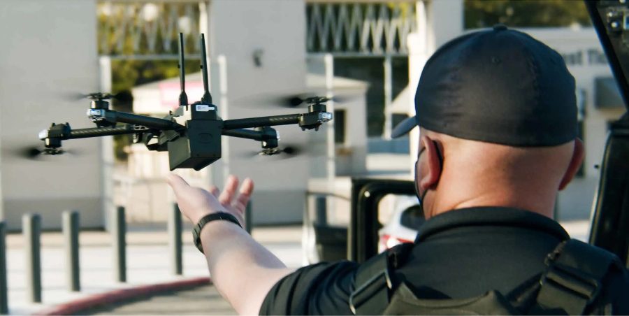
Credit: Skydio/Axon
Police departments have the most drone programs in the U.S., followed by fire departments. But drones are also used by first responders in emergency medical services (EMS), and search and rescue (SAR) units—in fact, search and rescue was one of the very first use cases for public safety drones.
Here are some of the most common uses for drones in public safety:
- Search and rescue missions. Drones are employed to locate missing persons in challenging terrains, such as forests, mountains, or after natural disasters.
- Firefighting support. First responder drones assess fire scenes, identifying hotspots and the spread of flames without endangering human lives.
- Crime scene analysis. Drones provide aerial photography and video that aid in reconstructing crime scenes and gathering evidence.
- Traffic collision reconstruction. Traffic analysts use drones to capture aerial views of accident sites, helping with detailed accident reconstruction.
- Disaster response. During disasters, drones are crucial for damage assessment, monitoring ongoing threats, and coordinating the distribution of aid.
In this guide to public safety drones we’ll cover what a public safety drone is, how to create a public safety drone program, and then look take a closer look at the three types of public safety agencies that commonly use drones, covering police, fire services, and search and rescue.
Here’s a table of content in case you’d like to jump around:
- Best Public Safety Drones + What to Look for in a Public Safety Drone
- How to Create a Public Safety Drone Program
- Public Safety Drones for Police Departments
- Public Safety Drones for Fire Departments
- Public Safety Drones for Search and Rescue
- Public Safety Drone FAQ
Best Public Safety Drones + What to Look for in a Public Safety Drone
Choosing the right drone for public safety applications involves understanding the unique demands of first responder operations.
Here are key characteristics to consider:
- Durability. Drones used in public safety must withstand varied and often harsh environments.
- Extended flight time. Longer flight times are crucial for sustained operations during emergencies.
- Reliable connectivity. Secure and stable communication ensures real-time data transfer and command execution.
- Night vision and thermal imaging. Essential for operations in low-light conditions or at night, and especially important for firefighting and search and rescue.
- Precision navigation. Advanced sensors and GPS capabilities to navigate difficult terrains.
Top 4 Public Safety Drones on the Market
Here are four of the top first responder drones on the market.
1. Skydio X2
Designed for challenging environments, the Skydio X2 is an autonomous drone equipped with AI-driven autonomy and offers exceptional obstacle avoidance. Ideal for search and rescue missions due to its advanced imaging and data capture capabilities.
- Flight time. Up to 35 minutes
- Range. 6.2 miles (10 km)
- Camera. Dual 12MP color and thermal sensors
- Weight. Less than 2 kg
- GPS. GPS and GLONASS for positioning
- Obstacle avoidance. 360-degree obstacle avoidance
- NDAA compliant. Yes, meets the supply chain requirements of the National Defense Authorization Act
- Blue UAS approval.Yes, included on the Blue UAS list for use by US government agencies
Learn more about the Skydio X2.
2. Anzu Raptor
Credit: Anzu Robotics
Engineered for versatility and robust performance, the Anzu Raptor stands out in public safety and inspection roles. It combines advanced flight capabilities with durable design, making it suitable for complex environments and critical missions.
- Flight time. Up to 40 minutes
- Range. 7 miles (11.3 km)
- Camera. Multi-sensor payload including 4K HDR video and thermal imaging
- Weight. Approximately 2.3 kg
- GPS. Enhanced GPS with RTK for precision positioning
- Obstacle avoidance. Equipped with advanced obstacle sensing technology
- NDAA compliant. Yes, meets the requirements of the National Defense Authorization Act
- Blue UAS approval. Application is pending, designed to meet criteria for government use
Learn more about the Anzu Raptor.
3. DJI Matrice 350 RTK
With thermal imaging and a secure data link, the ANAFI USA is suited for critical missions requiring stealth and data security, making it a favorite among law enforcement and emergency services.
- Flight time. Up to 32 minutes
- Maximum speed. 15 m/s (33.5 mph)
- Payload capacity. N/A (integrated camera system)
- Transmission range. Up to 4 km
- Camera options. 32x zoom, 21 MP visible camera, FLIR thermal camera
- Special features. Rugged design for all-weather use, 3-axis stabilization, secure data encryption
- NDAA compliant. Yes, suitable for governmental and sensitive operations
- Blue UAS approval. Yes, listed on the Blue UAS Framework to enable procurement by U.S. government agencies
Learn more about the Parrot ANAFI USA.
How to Create a Public Safety Drone Program
When it comes to developing a first responder drone program there are a lot of factors to consider, including regulatory compliance, training, how to find the right equipment for the needs of your specific agency, and how to find funding for that equipment.
There are also considerations around privacy concerns—which is especially important for those in law enforcement—and ensuring transparency with the public around how you’re using drones and what you’re doing with the aerial data you collect.
In this section, we’ll provide step-by-step instructions for helping you launch a public safety drone program, an example of how the L.A. Fire Department started its drone program, and a list of resources to help you learn more.
Here are links to each section for easy navigation:
- The Step-by-Step Process for Starting a Public Safety Drone Program
- Example: How the Los Angeles Fire Department Started Its Drone Program
- Public Safety Drone Resource List
The Step-by-Step Process for Starting a Public Safety Drone Program
1. Choose Your Operating Legal Framework
Public safety agencies can choose to operate their drone programs either under the FAA’s Part 107 rules or under a COA (Certificate of Authorization).
- Part 107. The FAA’s Part 107 rules outline the requirements for all commercial drone operations. Part 107 is suitable for operations that include daytime flying within the visual line of sight and below 400 feet in uncontrolled airspace—basically, regular commercial drone operations that don’t require special permissions, like flying BVLOS (Beyond Visual Line of Sight). For public safety agencies, operating under Part 107 can allow you to do routine surveillance and inspection tasks, but will be somewhat limiting for your operational capabilities.
- Certificate of Authorization (COA). COAs allow public safety agencies to operate under specific conditions tailored to their needs. A COA is necessary for more flexible operations like flying at night, above crowds, or beyond visual line of sight, operations which are otherwise prohibited by the Part 107 rules.
While operating under a COA can let you do things you can’t do under the Part 107 rules, like fly BVLOS, it can also be more complicated and time consuming to obtain a COA.
Many public safety drone programs choose to use both the Part 107 and the COA for their operations, getting their pilots Part 107 certified so they can start flying right away while they work through the COA application process.
How to Operate Under the Part 107 Rules
- Ensure eligibility. Confirm that all drone pilots have a valid Remote Pilot Certificate, which requires passing the FAA’s Part 107 knowledge test.
- Register your drones. All drones must be registered with the FAA, and each must bear a registration number. Register at FAA DroneZone.
- Understand the Part 107 rules. Familiarize yourself with all the operational limits under Part 107, such as flying during daylight hours, maintaining a visual line of sight, and not flying over people. Detailed information can be found on the FAA’s commercial drone operators page.
- Consider waivers. If your operation needs to exceed the standard limitations of Part 107 (e.g., night operations, flying over people), apply for a waiver from the FAA. This process can also be handled through the FAA DroneZone.
- Operational planning. Plan flights carefully to ensure all Part 107 rules are followed. Use tools like 1800wxbrief for airspace and weather checks.
- Continuing education. Keep your drone pilots updated with any changes in FAA regulations and ensure they undergo recurrent training every 24 months.
- Documentation and record keeping. Maintain records of all drone operations, including flight logs, maintenance, and any incident reports, which are crucial for accountability and compliance.
- Community engagement. Engage with the local community to address privacy concerns and educate the public about the benefits and regulations of drone operations in public safety.
How to Obtain a COA
- Determine eligibility. Ensure your entity qualifies as a public operator. Public operators include local, state, or federal government agencies.
- Register with the FAA. Before applying for a COA, your agency must have a registered account with the FAA.
- Understand the types of COAs. Decide whether you need a Jurisdictional, Blanket, or Emergency COA based on your operational needs. Details can be found on the FAA’s UAS public safety page.
- Prepare necessary documents. Gather all required documents, including detailed operation manuals, training records, and drone specifications.
- Submit your application. Apply via the FAA’s DroneZone or the paper N-number process if your operation requires an aircraft-specific COA. The application can be accessed at DroneZone.
- Public declaration letter. Include a declaration letter from your agency affirming that all operations will be conducted for a governmental function.
- Wait for review. The FAA will review your application. This process can take from several weeks to months, depending on the complexity of your application and current backlog.
- Comply with COA conditions. Once approved, ensure that all drone operations adhere to the specific conditions listed in your COA. Regularly update any operational changes or additional drones with the FAA.
- Annual COA renewal. Remember that COAs typically need annual renewal. Keep track of expiration dates and submit renewal applications well in advance.
See our guide on how to choose between a COA and Part 107 for more information.
2. Securing Funding
Creating a first responder drone program requires an upfront investment in drones, drone accessories, and drone software.
You can look for funding in:
- Grants. Look for federal, state, or private grants that support technological advancements in public safety. Websites like Grants.gov and Bureau of Justice Assistance are valuable resources.
- Public-private partnerships. Partner with technology companies that are interested in piloting and expanding their reach within public safety applications. These partnerships can provide funding or in-kind contributions of equipment.
- Local government budgets. Allocate a portion of your agency’s annual budget specifically for drone acquisition and training. Proposals may require demonstrating the drone program’s return on investment (ROI) and effectiveness in public safety.
- Community fundraising. Engage the local community through fundraising events or crowdfunding platforms, emphasizing how drones enhance public safety, such as search and rescue operations, firefighting support, and crime scene analysis.
- Donations. Solicit donations from local businesses or community members who are committed to improving public safety and technological capabilities of local law enforcement or emergency services.
3. Drone Selection
Select drones that best fit your operational needs, considering:
- Capabilities like thermal imaging for search and rescue.
- Endurance and durability for prolonged operations.
*See the section above for guidance on how to find a good public safety drone, as well as a list of the top first responder drones on the market.
Choose drones based on specific mission requirements, looking for key characteristics that are important for the work you do, including features like high-quality thermal imaging, high-resolution cameras, or extended battery life.
Pro tip:Ask other public safety agencies for advice. There are lots of agencies with drone programs out there, so there’s no need to recreate the wheel when looking for the right technology.
4. Comprehensive Training
Ensure all operators are proficient through:
- FAA Part 107 certification for basic operations. Drone Pilot Ground School provides training to help drone pilots pass the Part 107 test—learn more here.
- Flight training. Ensure general proficiency in flying. We provide hands-on flight training—learn more here.
- Advanced scenario-based training specific to public safety applications.
Here are some other types of training to keep in mind:
Ongoing/Continuing Training
To ensure skills remain sharp and current, ongoing training is crucial. This can include annual refresher courses, updates on new regulations or technology, and practice sessions to improve operational skills. Continuing education helps operators stay aware of the latest trends and maintain proficiency in drone operations.
Platform Specific Training
As drone technology evolves, specific training on the particular models and systems in use is necessary. Platform-specific training allows operators to fully exploit the capabilities of their drones, such as thermal imaging, zoom capabilities, or payload operations, and understand the limitations and maintenance requirements of their specific models.
Scenario-Specific Training
Public safety drone operators should be trained in scenario-specific operations that pertain to their fields, such as search and rescue missions, fire scene assessment, or tactical operations in law enforcement. This type of training involves simulated scenarios that may include night operations, flying in adverse weather conditions, or navigating complex environments.
5. Standard Operating Procedures (SOPs)
Develop detailed SOPs that address every aspect of your drone operations. Include protocols for maintenance, data handling, privacy issues, and emergency procedures. SOPs ensure consistency and legal compliance, significantly reducing operational risks.
Create SOPs that cover:
- Operational protocols and emergency procedures.
- Maintenance routines, battery management, and data handling practices.
6. Integration with Emergency Services
Effectively integrate your drone operations within existing emergency response protocols. This integration requires coordination with traditional emergency services and other air traffic control measures to enhance response capabilities without interfering with ongoing operations.
You can try to seamlessly integrate your drone operations with other emergency services by:
- Coordinating with local air traffic control.
- Training with other emergency service units to ensure collaborative response during operations.
7. Community Engagement and Transparency
Public trust is a big part of creating a public safety drone program, especially for police departments, where there can be community concerns about surveillance.
Engage with the community through workshops, demonstrations, and public meetings to explain the benefits and safety measures of your drone program. Transparency about drone usage, especially regarding privacy and data management, helps in maintaining public support.
Build public trust through:
- Regular public demonstrations and information sessions.
- Transparent communication about drone operations and privacy considerations.
- Sharing data about all drone operations, including location, day, time, and purpose of each mission.
Pro tip: Look for examples from other agencies.
For example, the Chula Vista Police Department is at the forefront of transparency in public safety drone operations.
They provide comprehensive insights into their drone program by making key data accessible to the public. This includes details on the number of drone launches, the purposes for which drones were used, and outcomes of the deployments.
This initiative is part of CVPD’s commitment to maintaining public trust and accountability in the use of technology in law enforcement. For those interested in viewing the detailed drone activity reports and related data, visit the Chula Vista Police Department’s drone data page.
8. Continuous Improvement
Implement a continuous evaluation mechanism to assess the effectiveness of the drone program. Collect feedback from operators, stakeholders, and the community to refine operations. Utilize emerging technologies and adapt to new FAA regulations to keep your program up-to-date and effective.
Continuously evaluate and improve your drone program by:
- Implementing feedback mechanisms for stakeholders and the community.
- Staying updated with the latest drone technologies and FAA regulations.
Example: How the Los Angeles Fire Department Started Its Drone Program
The Los Angeles Fire Department has one of the biggest, most successful public safety drone programs in the world.
Here is the step-by-step process it followed to launch its drone program:
1. Proposal of the Drone Program to the Board of Fire Commissioners
In June of 2017, the LAFD submitted a formal proposal to the Board of Fire Commissioners outlining its proposed policy governing the use of UAS in their operations. As part of their submission, they included an in-depth draft of an operations manual that was 30 pages long.
2. Strategic Plan on Innovation Meeting
Following the submission of their proposal, key representatives from the LAFD took part in a “strategic plan on innovation” with city and fire representatives.
3. Presentation to the Board of Fire Commissioners on Draft Operations Manual and Policy of Use
As a follow up to their formal proposal to the Board of Fire Commissioners, LAFD representatives made an in-person presentation to the Board of Fire Commissioners, in which they covered their draft Operations Manual and their Policy of Use.
Here is an excerpt from the proposed Use Guidelines:
USE GUIDELINES
We envision this technology being applied in two phases. Phase I will focus on use scenarios limited to:
- Hazard Assessment (with example) related to BUT not during the initial action phase of an incident.
- Hiker (Hi/low angle rescue) Incidents
- Swift Water Incidents
- Extended/Expanded Incidents (FIMT Activation)
- Planned Training Events
Phase II will be identified as the period of time after which the Department has completed the FAA’s process and obtains a Certificate of Authority. These use scenarios may include:
- Wildfire Mitigation
- Flood Response
- High Rise and Commercial Fires
- Hazardous Material Mitigation
- Search and Rescue
- Structure Collapse and Confined Space Rescue
- Pre-Incident Fire Planning
- Post-Incident Fire Review
- Creating Communication Networks during disaster response
4. Public Comment and Feedback/Review from ACLU
Following the presentation and review by the Board of Fire Commissioners, the LAFD opened up the drone program for public comment and review by the City Attorney and the American Civil Liberties Union (ACLU).
This step was crucial for getting buy-in, and demonstrating that the proper review steps had been taken to involve key stakeholders—not just those more internally concerned with operational matters, but also those concerned with how a drone program might be perceived by the public.
This review helped make the LAFD’s follow up letter to the Board of Fire Commissioners from Fire Chief Ralph Terrazas that much stronger.
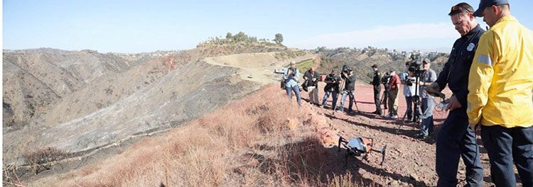
The LAFD demonstrating drone operations to reporters
The remaining steps are pretty self-explanatory, and were primarily focused on including key stakeholders, and providing maximum transparency and opportunities for interested parties to both see the value of the proposed drone program, and have a voice in how it was shaped:
5. Follow Presentation for Board of Fire Commissioners with Updated Draft Operations Manual and Policy of Use
6. Presentation to City Safety Committee, with Public Comment
7. Presentation to City Council for vote
8. After City Approval, Request to City Attorney for Declaration Letter
9. Declaration Letter Sent to FAA to Apply for a COA
10. COA Received in December
*This step-by-step list first appeared in this article we wrote about the LAFD’s drone program.
Public Safety Drone Resource List
Here are follow up resources to help you learn more about public safety drones and how to start your own first responder drone program.
- FAA Public Safety and Government Toolkit. Comprehensive guide on applying for a Certificate of Waiver or Authorization (COA) for drone operations in public safety.
- Public Safety Drone Playbook. Detailed playbook from the FAA outlining best practices for implementing drone technology in public safety operations.
- FAA Guidelines for Public Safety Drones. Official FAA page with guidelines and resources for setting up a Drone First Responder (DFR) program.
- National Fire Protection Association’s Guidelines. NFPA resources and case studies on the use of drones in firefighting and emergency services.
- International Rescue Committee Drone Operations. Training programs and operational guidelines for Search and Rescue (SAR) drone pilots provided by the International Rescue Committee.
- DRONERESPONDERS. The leading resource for public safety drone programs, offering networking, resources, and real-world learning for drone use in public safety.
Public Safety Drone Programs for Police Departments
Drones have revolutionized policing, offering new ways to enhance officer safety, gather evidence, and increase operational efficiency. This section explores key aspects of integrating drones into police work, providing practical advice and authoritative resources.
Drones for Law Enforcement
Here are drones specifically suited for police work:
1. BRINC’s Responder Drone