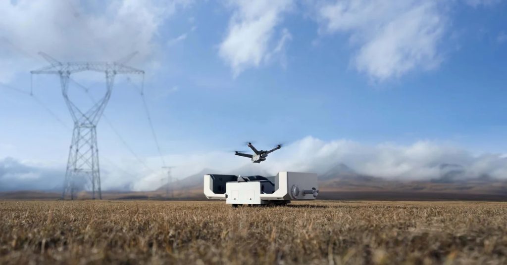
Powerline inspection drones are specialized UAVs made to inspect powerlines, poles, and other electrical infrastructure.
Credit: DJI
Equipped with advanced technology like high-resolution cameras, thermal imaging, and GPS systems, inspectors use these drones to collect data that helps them identify issues like:
- Damaged wires
- Overheating components
- Structural weaknesses
Without a powerline inspection drone, inspectors would have to climb powerlines to collect the same data—or use a helicopter.
Climbing is how these kinds of inspections have traditionally been done, but that presents a hazard to the inspector. And helicopters are just too expensive to use frequently for most inspections. Drones present a solution that is a safer, faster, and more precise approach to utility maintenance.
In this guide, we’ll look at the drones inspectors are using for powerline inspections, the software supporting this work, and the way these inspections are done. We’ll also cover jobs related to drone powerline inspections.
Here’s everything we cover:
- Best Powerline Inspection Drones [New for 2025]
- Powerline Drone Inspection Software [New for 2025]
- How a Drone Powerline Inspection Works
- 7 Key Benefits of Powerline Inspection Drones
- Should You Do It In-House or Hire an Inspection Service Provider?
- Drone Powerline Inspection Jobs
- Powerline Inspection Drones FAQ
Best Powerline Inspection Drones [New for 2025]
What exactly is a powerline inspection drone?
Really, any professional drone that allows inspectors to inspect, monitor, and collect data on electrical powerlines using precise locational technology could be called a powerline inspection drone. A drone doesn’t have to be made specifically for powerline inspections to be a good tool for the job.
That being said, there are specific drones that are best suited for this work.
Here’s a table with some of the best powerline inspection drones on the market:
| Model Name | Key Features | Typical Uses | Price Range |
|---|---|---|---|
| DJI Matrice 350 RTK | 6-directional sensing, 55-minute flight time, RTK GPS, payload compatibility (thermal, LIDAR, zoom cameras) | Close-range powerline inspections, thermal imaging, high-precision mapping | $12,000 – $20,000 |
| senseFly eBee X | Fixed-wing design, 90-minute flight time, RTK/PPK mapping, high-resolution RGB and multispectral cameras | Long-range surveys, topographic mapping, vegetation analysis | $10,000 – $15,000 |
| Skydio X2 | Autonomous navigation, thermal and optical cameras, 35-minute flight time, rugged design | Inspections in complex environments, obstacle avoidance in hazardous areas | $10,000 – $15,000 |
| Quantum Systems Trinity F90+ | Hybrid VTOL design, 90-minute flight time, multispectral and LIDAR payloads | Wide-area powerline mapping, vegetation management, structural analysis | $20,000 – $25,000 |
| DJI Mavic 3 Enterprise | Compact design, 45-minute flight time, thermal and zoom cameras, RTK module | Quick deployment for inspections, emergency response, visual fault detection | $5,000 – $7,000 |
| Autel EVO Max 4T | Thermal imaging, 48MP camera, AI-powered obstacle avoidance, 42-minute flight time | Detailed inspections, vegetation clearance analysis, thermal anomaly detection | $9,000 – $12,000 |
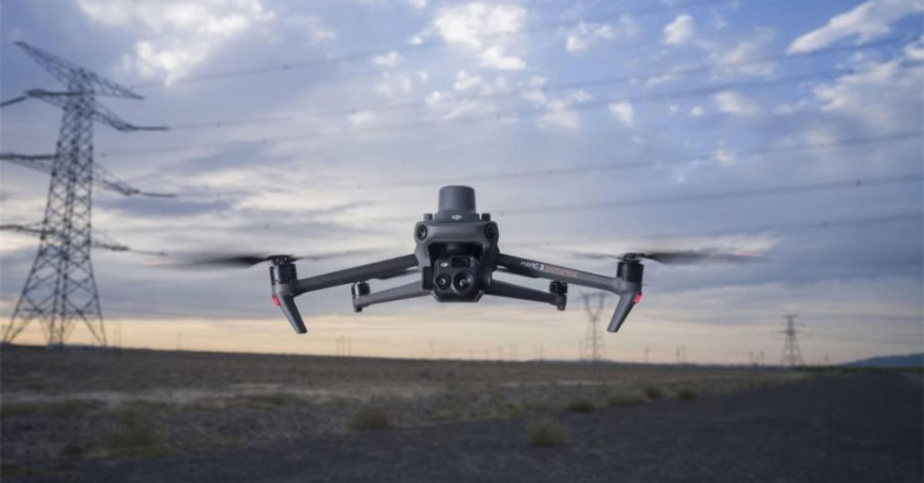
The Mavic 3 Enterprise | Credit: DJI
Types of Drones Used for Powerline Inspections
The type of drone chosen for powerline inspections depends on the task’s specific needs, including range, payload capacity, and flight stability.
Three primary drone configurations are used in powerline inspections: multirotor drones, fixed-wing drones, and hybrid drones. Each type offers distinct advantages for different scenarios, making them essential tools for modern infrastructure maintenance.
Multirotor Drones for Close-Range Powerline Inspections
Multirotor drones, such as quadcopters and hexacopters, are commonly used for close-range powerline inspections. These drones are highly maneuverable, allowing them to hover and navigate around poles, towers, and wires with precision. They are ideal for capturing detailed imagery and performing inspections in confined or hard-to-access areas.
- Key features. High-resolution cameras, stable hovering, advanced obstacle avoidance, and compact design.
- Example drones. DJI Matrice 300 RTK, Skydio X2, Autel EVO Max 4T.
Fixed-Wing Drones for Long-Range Inspections
Fixed-wing drones are designed for long-range inspections, making them suitable for covering extensive powerline networks efficiently. Their airplane-like design enables them to glide through the air with minimal energy consumption, allowing for longer flight times compared to multirotor drones.
- Key features. Extended flight duration, wide-area coverage, and integration with mapping software for data analysis.
- Example drones. senseFly eBee X, WingtraOne, Quantum Systems Trinity F90+.
Hybrid Drones: Combining Efficiency and Flexibility
Hybrid drones, also known as VTOL (Vertical Takeoff and Landing) drones, combine the strengths of multirotor and fixed-wing configurations. They can take off and land vertically like multirotor drones but transition to efficient fixed-wing flight for covering longer distances. This versatility makes them a powerful option for both close-range and long-range inspections.
- Key features. Vertical takeoff and landing capabilities, long-range flight efficiency, and compatibility with advanced sensors.
- Example drones. Quantum Systems Vector, WingtraOne VTOL.
Powerline Drone Inspection Software [New for 2025]
Powerline inspection drones leverage advanced technology and software to deliver accurate and efficient assessments of
Equipped with high-resolution sensors and intelligent software, these drones enable utility companies to detect faults, prevent outages, and optimize maintenance strategies.

A powerline inspection image made with LiDAR data
Features to Look for in Powerline Drone Inspection Software
Looking for software to do a powerline inspection by drone? Here are some guidelines to help you find what you need:
- AI-powered diagnostic tools. Artificial intelligence algorithms analyze images and thermal data to detect anomalies, such as damaged wires or corroded components, automatically.
- Mapping and modeling capabilities. Software like Pix4D and DroneDeploy generates 3D maps and digital twins of powerline networks, providing valuable insights for planning and maintenance.
- Inspection management systems. Platforms like Skydio Cloud and Percepto AIM integrate drone data into workflows, enabling real-time collaboration and efficient task management.
- Specialized drone apps. Specialized apps allow operators to monitor drones in real-time, adjust flight paths, and review collected data directly on-site.
Best Software Solutions for Drone Powerline Inspections
Here are the top software solutions for drone-based powerline inspections:
| Software Name | Key Features | Typical Uses | Website |
|---|---|---|---|
| Optelos | AI-powered analytics, automated defect detection, 3D modeling, and workflow standardization. | Comprehensive powerline inspections, predictive maintenance, and asset management. | optelos.com |
| Hepta Insights | High-resolution imaging, AI-based data analysis, GIS integration, and automation features. | Monitoring powerline conditions, detecting potential issues, and ensuring infrastructure reliability. | heptainsights.com |
| Airpelago Power | Flight automation, project management tools, and compliance support for BVLOS operations. | Standardizing drone flights, increasing inspection efficiency, and regulatory compliance. | airpelago.com |
| VOLT | Real-time data management, reporting applications, and integration with drone systems. | Infrastructure inspections, data analysis, and maintenance planning. | voltinspections.com |
| FlightSurv | 3D modeling, mapping capabilities, and user-friendly interface for various skill levels. | Surveying, mapping, and powerline inspection tasks. | jouav.com |
How a Drone Powerline Inspection Works
Inspections rely on data. And drones are just one tool among many that inspectors use to collect the data they need.
The unique benefit drones provide for data collection is that inspectors can use them to collect data remotely, allowing them to stand safely at a distance while getting all the data they need.
For powerline inspections, here are the primary types of data that inspectors collect by drone:
- Visual data. Drones with 4K or higher resolution cameras capture detailed visuals of wires, connectors, and insulators for close inspection.
- Thermal data. Thermal cameras detect overheating components and potential faults, helping identify issues before they lead to failures.
- LIDAR. LIDAR drones can collect data for the creation of precise 3D maps of powerline networks, enabling structural analysis and vegetation management.
- GPS and RTK Systems. Precision GPS systems, including Real-Time Kinematic (RTK) technology, ensure accurate flight paths and geotagged data collection.

Drone Powerline Inspection—Step-by-Step
Above we covered the types of data collected in a drone powerline inspection.
But how exactly do you collect this data by drone? And what do you do with it once it’s collected?
Here’s a step-by-step.
Step 1: Pre-Inspection Planning
Before the inspection begins, the drone powerline inspector plans the mission, taking into account the powerline network, weather conditions, and flight regulations.
Pre-flight planning includes:
- Mapping out the inspection route using GIS software or a dedicated powerline inspection drone app.
- Identifying potential hazards, such as trees, buildings, or other obstacles.
- Ensuring the drone is equipped with the necessary payload, such as high-resolution cameras, thermal sensors, or LIDAR.
Step 2: Launch and Flight
After setting up at a safe takeoff location, the inspector launches the drone. During the flight, the drone follows the pre-determined route or is manually piloted to specific inspection points.
Key aspects of this step include:
- Maintaining a safe distance from powerlines to avoid contact while capturing clear imagery.
- Using GPS and RTK (Real-Time Kinematic) technology for precise navigation and data geotagging.
- Ensuring compliance with FAA regulations or local aviation rules governing drone operations.
Step 3: Data Collection
The drone collects various types of data to assess the condition of powerline components. Real-time data transmission allows inspectors to monitor the drone’s feed and make on-the-spot adjustments if needed.
Data collection includes:
- Visual data. High-resolution images and videos of wires, connectors, insulators, and poles to detect physical damage, corrosion, or wear.
- Thermal imaging. Identifying hotspots or overheating components that may indicate electrical faults.
- LIDAR scans. Generating 3D models of powerlines and surrounding areas to assess structural alignment and vegetation encroachment.
Step 4: Post-Flight Data Analysis
Once the flight is complete, the inspector or pilot downloads the data and analyzes it using specialized software.
Analysis involves:
- Reviewing visual and thermal imagery for signs of damage or potential issues.
- Processing LIDAR data to create detailed maps and models of the powerline network.
- Generating inspection reports with actionable insights for maintenance teams.
Step 5: Reporting and Maintenance Recommendations
The final step is creating a comprehensive report based on the analyzed data.
Reports will highlight any detected issues, such as damaged components, vegetation risks, or alignment problems, and provide recommendations for maintenance or repairs. The report is shared with the relevant teams to ensure timely action and improved powerline performance.
7 Key Benefits of Powerline Inspection Drones
Powerline inspection drones offer numerous advantages that make them essential for modern utility maintenance.
From improving safety to optimizing costs, these drones are revolutionizing the way powerlines are inspected. Below, we outline the top benefits of using drones for powerline inspections.
1. Enhanced Safety for Utility Workers
One of the most significant advantages of powerline inspection drones is the improved safety they provide. Traditional powerline inspections often require workers to climb poles, navigate dangerous terrain, or use helicopters to access hard-to-reach areas. These methods expose workers to significant risks, including falls, electrical hazards, and accidents in remote locations.
Drones eliminate the need for direct human involvement in hazardous environments. Equipped with high-resolution cameras and advanced sensors, drones allow operators to inspect powerlines safely from the ground, reducing the likelihood of injuries and ensuring compliance with safety standards.
2. Time-Saving Efficiency in Inspections
Drones dramatically reduce the time required to inspect powerlines compared to traditional methods. Where manual inspections might take days or weeks to complete, drones can cover the same distance in a matter of hours. Their ability to fly directly to inspection points and provide real-time data ensures that utility companies can identify and address issues more quickly.
This efficiency is particularly valuable during emergencies, such as after storms or natural disasters, where rapid powerline inspections are critical to restoring service. By minimizing downtime, powerline inspection drones help maintain reliable energy delivery and customer satisfaction.
3. Cost Savings and Resource Optimization
The use of powerline inspection drones leads to significant cost savings for utility companies. Traditional inspections often require expensive equipment like bucket trucks, scaffolding, or helicopters, along with a larger workforce. Drones, on the other hand, require a smaller team to operate and maintain, reducing labor and equipment costs.
Additionally, the high accuracy of drone inspections helps identify potential issues before they become major problems, lowering repair costs and extending the lifespan of infrastructure. By optimizing resources and minimizing expenses, drones provide a high return on investment for powerline inspections.
4. Increased Data Accuracy
Drones equipped with advanced imaging technologies, such as LIDAR and thermal sensors, can capture detailed and precise data. This level of accuracy allows utility companies to detect even minor faults or anomalies that might go unnoticed during manual inspections. High-resolution geotagged images provide a clear record of powerline conditions, enabling better decision-making and more effective maintenance planning.
5. Reduced Environmental Impact
Compared to traditional inspection methods that often require helicopters or other heavy equipment, drones have a smaller environmental footprint. They consume less fuel and produce fewer emissions, making them a more sustainable option for powerline inspections. Additionally, their ability to operate quietly reduces noise pollution in residential or sensitive areas.
6. Versatility in Inspections
Drones are highly versatile and can adapt to various inspection scenarios. They are effective for routine maintenance, emergency assessments after natural disasters, and inspecting difficult-to-access areas, such as powerlines running through forests or mountains. Their flexibility ensures that utility companies can rely on them for a wide range of inspection needs.
7. Real-Time Monitoring and Reporting
With the ability to stream live video and data to ground operators, drones enable real-time monitoring of powerline conditions. This capability is particularly valuable during emergencies, allowing teams to make immediate decisions and prioritize repairs. Additionally, integrated software solutions streamline reporting, making it easier to share insights with stakeholders and maintenance teams.
Should You Do It In-House or Hire an Inspection Service Provider?
Investing in powerline inspection drones requires an upfront commitment, but the long-term savings and operational benefits often justify the cost.
On the other hand, hiring a third party service provider is a lot simpler and, in the short-term, less expensive.
So how do you navigate the decision? Here are some considerations to help you decide.

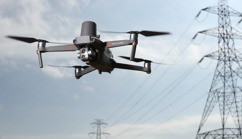
Credit: Skydio
Costs and ROI of Doing Drone Powerline Inspections In-House
The initial investment in a powerline inspection drone setup varies depending on the drone type, sensors, and software required.
Key costs include:
- Drone equipment. A professional-grade powerline inspection drone typically costs between $10,000 and $50,000, depending on its features. For example, drones with LIDAR or thermal imaging capabilities are on the higher end of the spectrum.
- Software. Powerline drone inspection software and apps for data analysis, such as Pix4D or DroneDeploy, often involve subscription fees ranging from $1,000 to $5,000 annually.
- Training. Operator training, including obtaining an FAA Part 107 certification, can cost $500 to $2,000 per individual, ensuring safe and effective drone use.
Ongoing Costs: Maintenance, Insurance, and Upgrades
In addition to upfront expenses, ongoing costs play a significant role in maintaining a drone program. These include:
- Maintenance. Regular upkeep, including battery replacements, motor servicing, and sensor calibration, can cost $1,000 to $3,000 annually.
- Insurance. Drone insurance to cover potential damages or liabilities is typically $500 to $2,000 per year.
- Upgrades. As technology evolves, companies may need to upgrade drones or software to stay competitive, incurring additional costs every few years.
Long-Term Cost Savings and ROI
Despite the initial and ongoing expenses, powerline inspection drones provide substantial long-term savings and a strong ROI. Key benefits include:
- Reduced labor costs. Drones eliminate the need for large inspection crews or specialized equipment like bucket trucks, cutting labor expenses significantly.
- Faster inspections. Completing inspections in hours rather than days reduces downtime and boosts operational efficiency.
- Minimized risks. By keeping workers on the ground, drones reduce the likelihood of accidents, lowering liability and associated costs.
- Enhanced data quality. High-accuracy data allows for proactive maintenance, preventing costly outages or repairs.
Cost and ROI for Hiring a Third Party
For companies considering powerline inspections, hiring a third-party service provider can be an alternative to purchasing and operating their own drones. This option comes with its own cost considerations and potential return on investment (ROI), which should be evaluated carefully before making a decision.
Costs of Hiring a Third Party
- Per-inspection fees. Third-party providers typically charge based on the scope of the project, ranging from $2,000 to $10,000 or more per inspection, depending on the complexity and size of the powerline network.
- Subscription models. Some companies offer ongoing inspection services on a subscription basis, providing regular monitoring and reporting for a monthly or annual fee.
- No upfront investment. Unlike purchasing a powerline inspection drone, hiring a third party eliminates the need for upfront costs related to equipment, training, and software.
Benefits of Hiring a Third Party
- Expertise and equipment. Professional service providers often have access to the latest drone technology and software, as well as experienced operators, ensuring high-quality inspections without requiring in-house expertise.
- Faster implementation. For companies without an established drone program, third-party services can provide immediate access to drone-based inspections without the time and effort needed to build internal capabilities.
- Reduced liability. Outsourcing drone operations can reduce liability and compliance risks, as the third-party provider assumes responsibility for regulatory requirements, including FAA certifications and flight safety.
Comparing ROI: In-House vs. Third Party
Here are some factors to consider when trying to decide between buying a powerline inspection drone and creating a drone program or hiring a third party:
- Frequency of inspections. For companies requiring frequent or large-scale inspections, owning drones may offer a better ROI over time due to lower per-inspection costs.
- Budget and resources. Smaller companies or those with limited budgets may find third-party services more accessible and cost-effective, particularly for occasional inspections.
- Operational control. Owning drones provides greater control over scheduling, data handling, and integration with internal systems, which may be important for some organizations.
So—What Should You Do?
As you can see, both options—purchasing drones or hiring a third party—offer distinct advantages.
We recommend crunching the numbers using the guidelines above to inform your decision. In addition to looking at ROI, we also recommend thinking strategically about how you see drones involved in your operations.
Do you see drone inspections as a permanent part of your work? Or is it too early to tell? If it’s too early, it would probably be best to hire out the work, then see how things develop.
But if you know that drones are the future for your powerline or other inspections, then it could be a good idea to start the hard work of building your drone program now, even if you continue relying on a third party for some of your drone inspection needs.
Drone Powerline Inspection Jobs
The demand for drone powerline inspection jobs is expected to grow significantly as utility companies increasingly adopt drone technology to improve efficiency and safety.
The combination of cost savings, enhanced data accuracy, and regulatory compliance has made drones a critical tool in infrastructure management, driving job creation across the industry.
Below, we cover the places where people are finding work in drone powerline inspections, and about how much they’re making doing this work.
Career Opportunities in Powerline Drone Inspections
Powerline inspection with drones requires a multidisciplinary approach, offering roles for individuals with diverse skills:
- Drone pilots. Certified drone operators are responsible for planning and executing inspection flights, ensuring accurate data capture and safe operations. These roles often require an FAA Part 107 certification and experience with professional-grade drones.
- Data analysts. Specialists analyze images and data collected by drones, using software tools to identify faults and recommend maintenance actions. A background in GIS or data science can be advantageous for these roles.
- Maintenance technicians. Technicians handle the upkeep of drone equipment, including sensor calibration, battery replacement, and software updates, ensuring reliability and performance.
Drone Powerline Inspector Salary: What to Expect
Salaries for professionals in the drone powerline inspection field vary depending on experience, certifications, and the specific role. Below is a breakdown of typical salary ranges:
- Drone pilots. Entry-level pilots can earn between $50,000 and $70,000 annually, while experienced pilots with advanced certifications or specialized skills can earn upwards of $100,000.
- Data analysts. Analysts typically earn between $60,000 and $90,000, with salaries increasing for those skilled in AI-powered inspection software and GIS mapping.
- Maintenance technicians. Technicians can expect to earn $40,000 to $60,000 annually, with potential for growth as they gain experience with cutting-edge drone technology.
Powerline Inspection Drones FAQ
What is a powerline inspection drone?
A powerline inspection drone is a specialized unmanned aerial vehicle (UAV) used to inspect electrical powerlines, poles, and other infrastructure. These drones are equipped with tools like high-resolution cameras, thermal sensors, and LIDAR to detect faults, identify hazards, and collect detailed data for maintenance and safety purposes.
How much does a powerline inspection drone cost?
The cost of a powerline inspection drone varies widely based on its features and capabilities. Entry-level models may start at around $5,000, while professional-grade drones with advanced sensors and software can cost between $10,000 and $50,000 or more.
What certifications are required to operate a drone for powerline inspections?
To operate a drone for powerline inspections in the U.S., drone pilots must hold an FAA Part 107 Remote Pilot Certificate. Additional training in thermal imaging, LIDAR, or inspection-specific software may also be beneficial, depending on the job requirements.
What drones are used for powerline inspection?
Popular drones for powerline inspections include the DJI Matrice 300 RTK, senseFly eBee X, Skydio X2, and Quantum Systems Trinity F90+. These drones are equipped with features like thermal imaging, RTK GPS, and extended flight times, making them ideal for utility maintenance tasks.
What is the best drone for utility inspection?
The best drone for utility inspection depends on the specific needs of the project. For close-range inspections, the DJI Matrice 300 RTK is a top choice due to its versatile payload options. For large-scale mapping, fixed-wing drones like the senseFly eBee X are highly efficient.
How can drones improve the safety of pipeline and power line inspections?
Drones improve safety by eliminating the need for workers to climb poles, navigate difficult terrain, or use helicopters. By capturing detailed data from the ground, drones reduce the risks associated with traditional inspection methods while providing faster and more accurate results.
What software is used with powerline inspection drones?
Powerline inspection drones often use software like Pix4D, DroneDeploy, or Skydio Cloud for mapping, data analysis, and inspection management. These tools enable operators to process collected data, create detailed reports, and collaborate with maintenance teams in real time.
Are powerline inspection drones cost-effective?
Yes, powerline inspection drones are cost-effective. They reduce labor costs, minimize the need for expensive equipment like bucket trucks, and enable proactive maintenance by identifying faults early. These factors contribute to a high return on investment for utility companies.